
Command, Control and Communications[GCS]
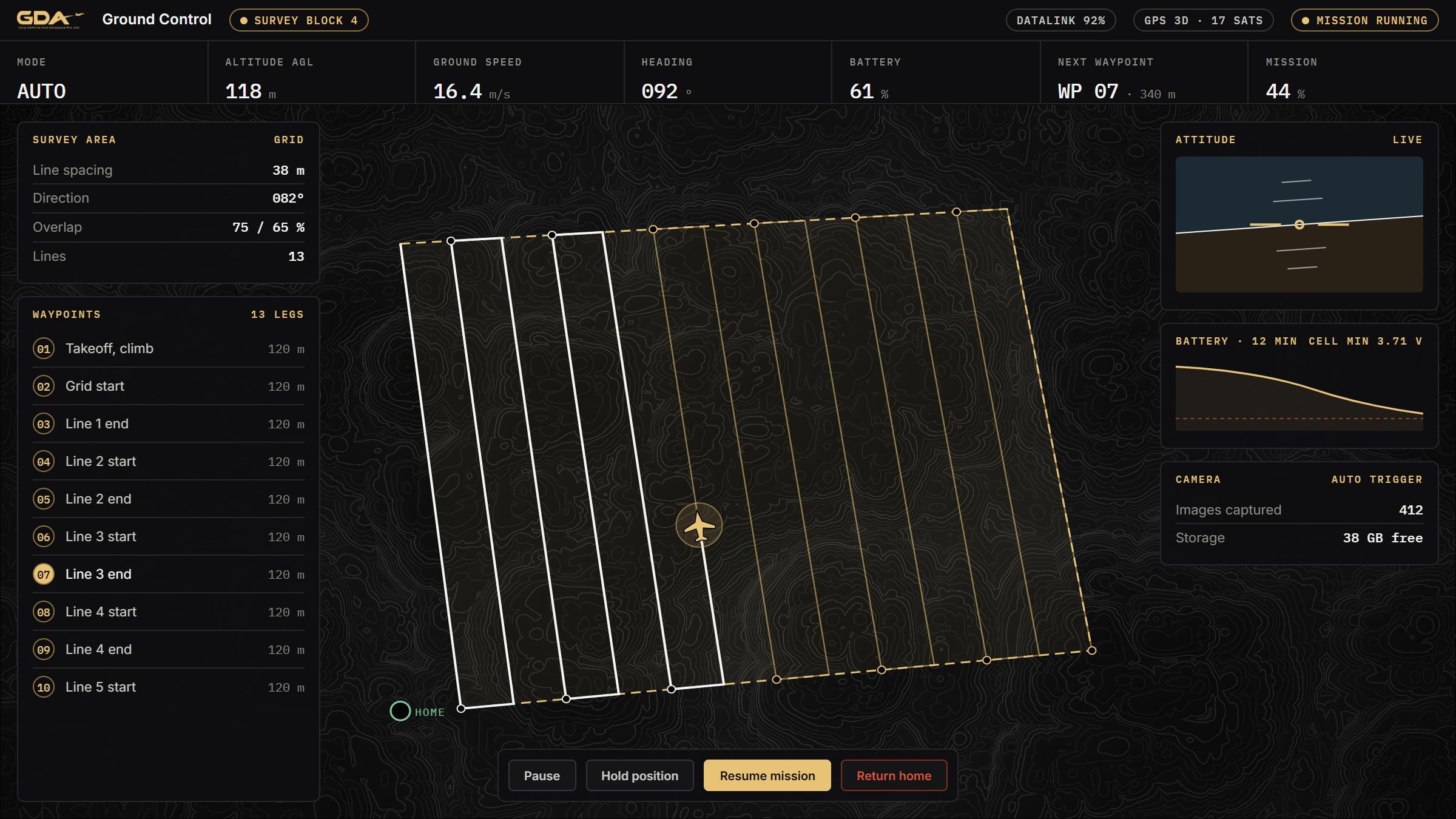
A browser-based control station for a single aircraft: mission planning, live telemetry, geofencing and full flight records.
- Installation
- None, browser based
- Telemetry
- Full vehicle state
- Survey grids
- Generated from a boundary
- Flight record
- Every sortie
Overview
A control station should not need installation on every laptop that might have to use it. This one runs in a browser on whatever machine is at hand and connects to the aircraft over a serial radio link, showing the same live state a purpose-built ground station would.
Missions are planned on the map, including automatic survey grids from a drawn boundary. Geofences, speed and altitude limits are set before launch. Everything the aircraft reports is displayed and recorded, and a transmitter plugged into the laptop becomes a real control link when hands-on flying is needed.
System qualities
01 / 05
Opens in a browser
No installation, no per-machine licence. The station runs on the laptop that is present, including one that has never seen the aircraft before.
02 / 05
Survey grids from a boundary
Draw the area, set spacing and altitude, and the mission is generated, uploaded and flown automatically.
03 / 05
Limits set before launch
Geofence, maximum altitude, radius, speed and the action on breach are configured and verified on the ground.
04 / 05
Everything the aircraft knows
Mode, satellites, attitude, battery, link quality, wind estimate, navigation state and message feed, live and recorded.
05 / 05
A transmitter is a real link
A transmitter plugged into the laptop drives the aircraft as a bound receiver would, with a deadman timeout that hands control back the moment the link stops.
Specifications
Figures marked undisclosed or on request are released against a stated requirement.
Software
- Delivery
- Browser based, served locally
- Vehicles
- Single aircraft
Link
- Bearer
- Serial radio link or direct
Planning
- Missions
- Upload, download, clear, resume
- Survey grid
- Polygon, spacing and altitude
Safety
- Geofence
- Altitude, radius, polygon, breach action
- Limits
- Maximum waypoint speed and altitude
Telemetry
- Reported
- Mode, position, attitude, battery, link, wind, navigation
- Recording
- Per-sortie flight log
Control
- Manual
- Transmitter over the station, deadman timeout
Parameters
- Management
- List, search, set, save and restore
Documentation
- Command, Control and Communications overviewAvailable on request
Applications
Works with
These are built to operate together, on one network and one picture.
Plan, fly, record.